Viewing entries tagged
Renewable Energy

Solar panel siting using custom QGIS plugins

Solar panel siting using custom QGIS plugins

GPA is wrapping up an exciting month-long project to build Hexagon Energy a custom QGIS plugin to assist project managers in identifying appropriate locations for solar panel placement at the parcel level. When incorporated into their existing development workflows, this plugin will identify the area within individual parcels for solar panel placement taking into consideration setbacks from property lines, floodplains, and wetlands. Project managers can take this information into the field, sit across the table from landowners and be more prepared to discuss contract details; reducing the development timeline and installing solar panels more efficiently and quickly.

The custom plugin is built on QGIS open source python scripting libraries and can be downloaded directly into a QGIS project. After project staff have run through the initial site selection process at a county (or regional) level to identify priority parcels for further investigation, marketing and outreach, staff load the primary datasets for analysis. The plugin allows users to define setback requirements based on specific county development codes or ordinances making the plugin functional across all geographic regions.

plugin.JPG

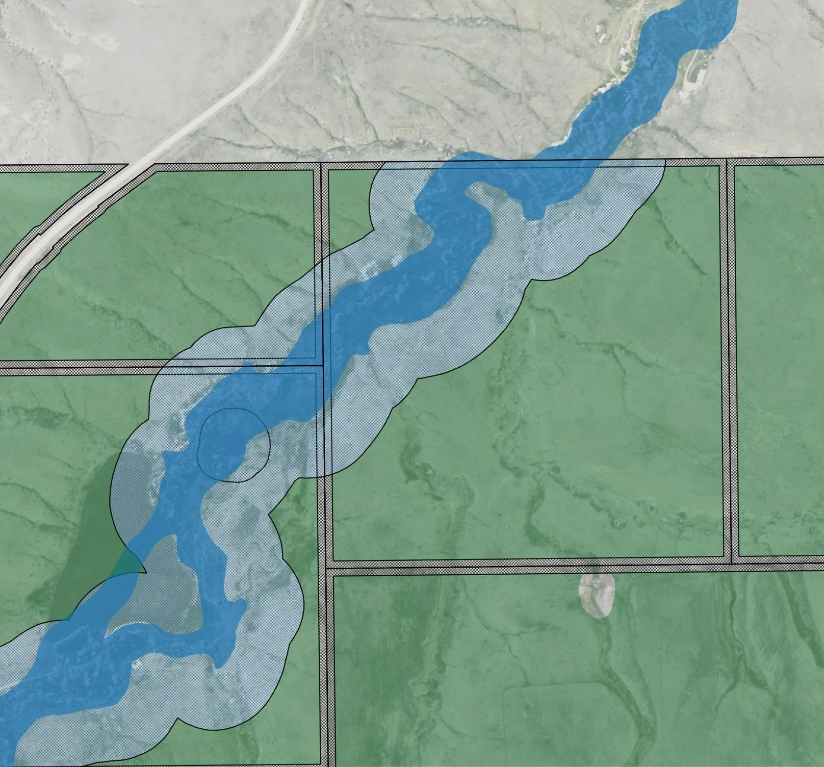
The plugin returns a vector shapefile of buildable area by parcel. The buildable area vector file retains the original parcel information allowing for easy owner look-up and calculating total acreage of buildable area. This tool replaces the need for project managers to manually outline and estimate buildable area using Google Earth or other web service data layers. Future versions of the plugin will incorporate slope and aspect to further refine the total buildable area.

And...We're off!

Colleagues, friends, and family:

As many of you know, I’ve been providing geospatial analysis and environmental planning consulting services part time through my company, Geospatial Planning Advisors (GPA), over the past few years. Last February I accepted a one year position as a Water Resources Fellow with the Interstate Commission on the Potomac River Basin even as I continued to work on small consulting projects on the side. It was at times a hectic year but nonetheless a rewarding experience.

I am excited to announce that I am transitioning to GPA full time beginning today and have a number of contracts lined up.  We are also seeking funding to develop a web app to assess watershed restoration projects at a watershed scale. GPA is an environmental and land use planning firm focused on the intersection of policy and technology, utilizing GIS to help solve complex environmental problems. We have experience in watershed management, conservation planning, sustainable economic development, spatial planning, and renewable energy development.

I recently asked my good friend and colleague from Cal Poly, Kyle Perata, to join me in this endeavor. We look forward to working with you to make positive change in the environment and in our communities in 2017 and beyond.

Please check out our website www.geospatialplanning.org or follow us on Facebook. Give us a shout if you have any advice, leads, or just want to talk about maps sometime.

Are solar panels the new cover crop in Virginia?

Are solar panels the new cover crop in Virginia?

A new law introduced in the 2017 General Assembly will allow agriculture net metering for solar arrays and allow farmers to sell excess energy back to utilities at market rates. Existing state legislation does not allow owners of small, detached solar arrays to sell energy back to utilities.

This is great news for advocates of renewable energy but also great news for water resource professionals. If passed, this is another tool in the toolbox planners can use to reduce nutrient pollution from agriculture and improve local water quality. Under this bill, farmers have another option for supplementing income on low-yield fields. Instead of asking farmers to carry the financial burden of removing land from production, small solar arrays can help offset the costs of leaving land fallow beyond the lifetime of agriculture cost-share programs. Moreover, solar development will provide a more consistent revenue stream for landowners. As the weather becomes less predicable in a changing climate, solar power development can be an insurance policy against a less certain future growing season.

Of course small-scale solar arrays will not be the solution for all farmers; however, through geospatial analysis, low-yield fields with high potential for solar power development can be targeted as a component of watershed management plans where nutrient runoff is causing water quality impairments. Removing low-yield, high-nutrient runoff land from agriculture production and installing solar panels is a win-win-win for farmers, watershed managers, and renewable energy advocates.